
After a good breakfast at the hotel I start rather late. To my surprise the sky is grey and some raindrops are falling. But soon enough it is warm and sunny again.
After a short stretch on a cattle trail, I walk some time on a dirt road, until I reach the Campground Huinganes, which would make a nice place to stay overnight. It even has a pool! The owner explains, where the horse trail begins, which starts from here.

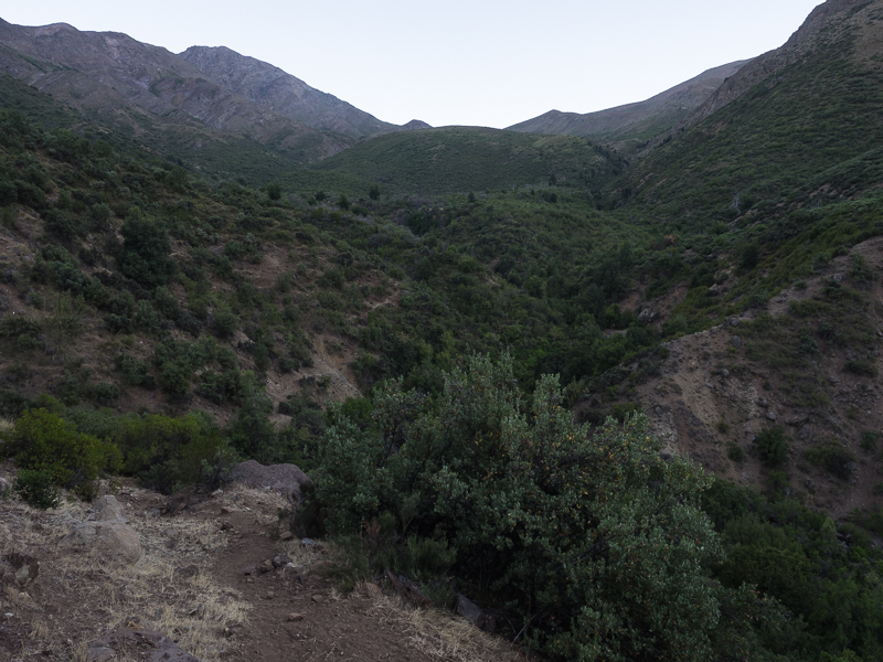
It is easy to follow the trail, which makes a good hiking route. The vegetation is surprisingly dense and reminds me on mediterranean macchia or californian chaparal.

I follow the valley of Estero Huinganes and then ascent to a low pass. Soon after I reach Rio Arenillas where I manage to fall into the water by balancing the slippery rocks. Just refreshing at these temperatures! I carried 4,5 litres from Termas de Cauquenes, but to my delight I learn, that the rivers have water, so it is not necessary to carry much.

A good trail passes Casa de piedra, a rock which makes a good hide in bad weather.

I climb to another pass from where I have nice views in the valley of Rio Claro, which I will follow for a long time.

As the valley is quite steep in many places, the trail mostly runs high above on the shoulder.

In places the route was heavily overgrown and just recently cleared by nice people! I hope it continues like that, otherwise the hiking in this dense, thorny vegetation would be quite difficult...
It seems this trail is used frequently, at good camping spots I see fireplaces and beer cans...
Nevertheless I just meet two men, surprisingly not on horse, but walking as well!

While I put up my camp on a flat, open place someone visits me: A large grey fox, more resembling a coyote appears nearby but soon is hidden again in the brush.


To my horror the cleared stretch of the trail ends soon the next morning, so there is a lot of slow bushwacking...


At some places I have to scout some time to find out were the trail continues, because I soon notice, that even if the trail is overgrown, it is still much better than no trail!
Sometimes I have to cross the river, because the route continues on the other side. Near the river there is a good number of ideal campsites, with shady trees. Although the trail has not seen much use recently, there are some old campsites.
In a shady grove I spot a bird of prey, which sits only about 7 meters away from me and surprisingly is not shy at all.

In the afternoon the trail has completely disappeared and I need to find my way cross country. To climb out of the valley is quite hard, because I need to negotiate a number of steeply cut side valleys.

Eventually I reach a pass at 2020 metres.

First the descent on the other side is rather flat and easy.

But when I reach a steep step with very thick vegetation, the most difficult bushwacking of my trek in Chile starts. I try to link some clearings I spotted from above, but at some point it is almost impossible to continue, so I have to return and scout for another route.

Eventually I find a faint cattle trail, on which I am able to descend without too much difficulty.
I had hoped that on the plateau down below the walking gets easier, but even there the vegetation is very dense. Although there is cattle and some tracks, there is no clear direction, so I circle around and don't make much progress.

But luckily I find a cattle track, when I need to descent steeply again, to reach the valley of a creek, where I find a nice camping spot.

Jan has marked the gpx-tracks of today as not verified, so I proofed that it is possible to use this route. The hiking was strenous and sometimes difficult, but I am satisfied to have made it!
Next morning I soon reach the confluence of two creeks and continue on the right side of Estero Tierras Fovas. The trail disappears and I climb upwards in hope of avoiding the deepest thickets. On a ridge it becomes clear, that the other side of the river is easier to negotiate, so I descend steeply and finally find a good trail.
The terrain is still steep and difficult, but after I pass some fences the trail is easy to follow and I proceed rather quickly.

As I saw nobody yesterday I am quite surprised to meet a lonesome, proud rider with a packhorse. We greet each other and carry on without chatting, which is a pity, but my spanish is limited and I get the feeling that the mountain people often are rather timid.

Here at around 850 metres it is again very hot and tall cacti intersperse the thorny bush vegetation.

When I see the swift Rio Claro de Rengo, I know that the crossing will be difficult. I walk upstream to find an appropriate spot and finally give it a try. But after a few steps I turn back, the river is far too fast and deep! Now I try downstream and eventually find a good crossing point where the water is rather shallow.

On the other bank there is a dirt road, some pastures and a homestead, but soon I leave the valley and ascent on a good, but steep trail.
 |
| A long ascent
I climb about 1000 metres before I reach a pass at 1770 metres. The valley on the other side is rather flat and eventually I reach a high plateau where I want to put up camp. A group of Arrieros comes riding down the slopes from the direction I want to continue tomorrow. The camping spot I chose first is nice under some trees, but unfortunately there are a lot of ants, so after dinner I change to the open plateau...

High plateau
After the sun has set, a giant full moon rises and plunges the landscape in magical light. While I sit outside and enjoy the night I hear the growling sound of an owl not too far away.
  
The full moon rises
At dusk I am on the good trail, the Arrieros used yesterday. I climb around 350 metres to a beautiful mountain landscape around 2000 m.

I enjoyed the last days when I mainly walked in the valleys as well, but being again high up with the view reaching to the now distant snowy mountains near Santiago is superb.
 Beautiful mountain scenery 
There is only one thing which disturbs my good mood a bit: Some large black gadflies appear, and try constantly to bite me. They are powerful swift flyers, but when they land on the skin, they are not fast, so it is quite rare that they succeed...
I stay high for some time and circumnavigate two valleys, but finally around noon the descent starts.

Here at the upper end of the valley cows are living and I follow their tracks for some time.

But after some time I realize, that I lost the gpx-Track which runs further down and fear to end in a blind alley. So I descend in very steep terrain for about 200 metres and reach a good trail again!
From above the vegetation in the valley now looks different and when I get further down I am in real forest for the first time of the hike!

It is hard to believe, that in this valley giants grow, who have their domain a lot further south! But for me as a forest lover, this is heaven! The dark barked Coigues are especially impressive!
 First time in real forest with giant trees
There is even a beautiful creek with numerous cascades flowing across the shade.

Soon a frequently used trail appears, there are some fences and I have to climb two gates.
In the broad Estero Antivero valley there is a trail almost resembling a road. I get to the hut of a lone settler, but see nobody, besides the barking dogs.
I know, that civilisation is not far, therefore I decide to cowboy camp although it is quite early. The river invites me to bath and I enjoy the hot temperatures here at 740 m.

Cowboy camp near Estero Antivero
Early next morning I meet a proud rider, wearing a white poncho and long knife on his belt... Soon I follow a dirt road and the first poor houses appear. Some dogs run barking towards me, but when I put up my walking sticks, they withdraw. The signs at a gate say "No trespassing, no fishing"..., so I don't feel very comfortable as I am obviously not legal here... But as I already know, these signs are usually not really enforced, at least not to harmless hikers... I reach a road at Agua Buena, a small village with a campground and a small shop where I buy some food and icecream! Soon I leave the road, and walk for a short distance along plantations of grapes and fruit trees.  It doesn't take long before I walk again in dry, low thorny forest. Here I meet two old guys who make their living by producing charcoal.  This technique was once in europe important as well, but already has disappeared since more than 200 years. The trail slowly fades away and soon enough I have to crawl across really bad thorny vegetation. I have a hard time so near to civilization!   When I reach the edge of the plantations the walking gets easy again. I cross the mighty, grey glacier fed Rio Tinguiririca on a suspension bridge and then need to walk about 5 hot, boring kilometers on a straight dirt road. Some people offer me a ride or something to drink, but I stupidly insist on walking...  To my surprise there is a good number of busy campgrounds in Las Peñas, just before the bridge over Rio Claro. I check in and enjoy the cool bath in the pool... Today was hot, and partially tiring.  After crossing the River next morning I take a dirt road which slowly ascents the hills. Somehow the landscape with artificial coniferous forests reminds me of the german hills. Then I reach a gate which could be the entrance to a high security tract in a prison... It is impossible to climb, so I detour via the thick brush.  I carry on along the road with very mixed feelings, because I fear the consequences when I meet somebody who works on this well guarded estate.  Hidden in the vegetation some steps away from the road is a strange settlement, encompassing mongolian yourts! Kind of an esoteric eco project? I meet nobody there, so it remains a miracle...  I pass some green meadows where horses graze and get to a house, where the road branches. Somebody is working outside and I ask for directions, well aware that I might get a problem now. But nothing happens, the guy is friendly and wishes me well. Along the road I see earth brown flickers, cousins of the woodpeckers.  After some hours the dirt road turns to a good foot path. While I want to sit down on my closed cell mat, I realize, that I have lost it! It was tied on top of my backback and probably I lost it on crawling through the thicket at the gate. That place is already far away, so I decide not to go back, instead I will do without the mat from now on... The trail climbs rather steep up the valley of Estero Tumuñan and makes me sweat a lot...  When I leave the valley good views open, back to Rio Tinguiririco and some snow capped mountains. Some horses seem to live a free life in these vast spaces.  It is already five in the afternoon when I reach a pass at about 2500 meters.   I descend only half an hour more and pitch camp at the beautiful Laguna Fria at 2300 meters. This is one of the best camps of the hike so far!    As my woodstove only needs small sticks, I am able to cook and enjoy dinner at this fantastic camp. Although I ascended more than 2000 meters today I still feel energetic enough for an evening walk. Even at this altitude I find cacti.  From a rocky knob nearby I absorb the mountain scenery with beautiful clouds.  Later I climb the steep slopes surrounding the lake and find some small ponds with a couple of Andean Geese on top. At sunset the clouds lift and offer spectacular views on snow capped Volcan Planchon.     I use extra clothes as isolation against the ground which works good, although the night up here is quite cold. While I get up next morning the setting moon still illuminates the landscape, magic of nature!  There are only faint tracks, but the descent is quite easy and soon another lake appears.  There would be good campsites as well, but I like my spot of last night more. For a long time I descent steeply on a ridge dividing two valleys. Although the landscape is quite dry, there are some beautiful flowers.  Finally I look down into the upper valley of Estero La Palma in which I will descend for a long time.  A lone arriero comes riding from below, accompanied by his dogs. I tell him, that I saw no cows near Laguna Fria.  The trail which leads down is quite good, and soon I reach the treeline, made of sturdy cypreses.  Before noon I am in real forest, mostly formed by the southern Beech, Roble. Their leaves resemble a bit those of european Beeches.   Beautiful lizards take a sunbath on grey tree trunks.  Further down the valley there are some cattle fences, provisional tents of the Arrieros, and once I meet three guys, who take a nap, hat on the face, like one would imagine how real cowboys sleep!  Once in a while I need to cross the river, which always can easily be done balancing on the rocks.  The lush forest is confined to the wet valley, on the slopes there is still bare ground or low shrub.  I think I could reach Los Quenes today, but as I want to take a ride to Curico, to buy new provisions, I prefer to camp on the river, which has some nice bathing spots. Continuing next morning it is still surprisingly far to Los Quenes and the river forms a canyon with steep rocky sides.  I need about two hours to reach the large Rio Teno and then follow the dirt road for a kilometer to Los Quenes, a quiet little town with shop, restaurants, campgrounds and other acomodation.  As I want to buy food for 20 days, I prefer to go to Curico, a large town, about an hour from Los Quenes. Soon I hitch a ride and when the pick-up has reached its destination it doesn't take long before I can take a bus which brings me to Curico. This is not a tourist town and has few attractions, but I am able to buy the food for the next stage in a supermarket. It is hard to believe, but I manage to cram that huge amount of provisions in my 45 liter backpack... |
Keine Kommentare:
Kommentar veröffentlichen